

Experience San Francisco like a local by exploring its hidden neighborhoods and authentic city life beyond tourist spots.

San Francisco is one of the most visited cities in the United States and one of the most consistently misvisited. Most first-timers spend their days moving between Fisherman’s Wharf, the Golden Gate Bridge, and Pier 39 and leave having seen the city’s most tourist-facing surface rather than the place itself. Getting underneath that surface does not require insider knowledge so much as a different approach to the basics: where you stay, how you move around, and which neighborhoods you actually spend time in.
Where you base yourself determines almost everything
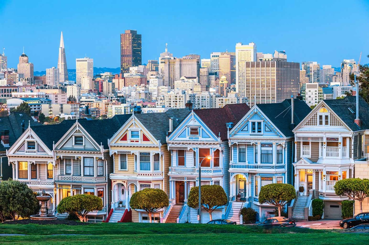
San Francisco is compact by American standards, but its neighborhoods are divided by hills steep enough to make the wrong base genuinely inconvenient. The tourist infrastructure clusters around Fisherman’s Wharf and Union Square, but the neighborhoods that reflect how the city actually lives are elsewhere. The Mission District, roughly three miles south of Fisherman’s Wharf, is where a significant portion of the city’s best independent restaurants, coffee shops, and bars are concentrated, alongside murals, bookshops, and a street culture rooted in the neighborhood’s Latino heritage.
The Castro, adjacent to the Mission, has its own distinct identity built around one of the most significant LGBTQ+ communities in American history. Haight-Ashbury carries the physical remnants of the 1960s counterculture – the Victorian houses, the independent record stores, the stretch of vintage shops on Haight Street – that the city’s tourism materials reference constantly, but the tourist circuit rarely visits. A search for cheap hotels in San Francisco in the Mission or Lower Haight puts you in the right part of the city for this kind of trip at a lower price point than Union Square.
The Fog is not an Inconvenience – it is How the City Works
San Francisco’s microclimate is one of the defining features of daily life, and one of the things first-timers most consistently misread. Karl – the nickname locals use for the fog that rolls in off the Pacific most summer afternoons – is not a weather failure. It is the reason the city’s western neighborhoods stay cool while the inland areas warm up, and it is why summer afternoons in the Sunset or the Richmond feel like a different season from the same afternoon in the Mission or Potrero Hill. Locals dress in layers regardless of the season, keep a jacket accessible even on clear mornings, and plan outdoor activities for the morning before the fog builds. Doing the same removes one of the most common sources of tourist frustration and puts you in step with how the city approaches its own climate.
Move The Way Residents Mmove
The MUNI bus and streetcar network covers the city more comprehensively than most visitors realize, and BART – the Bay Area Rapid Transit system – connects Downtown to the Mission, the Castro, and the outer neighborhoods efficiently. Locals combine the two rather than relying on ride-shares for every journey. The cable cars, which run on three lines, are a genuine piece of working infrastructure as well as a tourist attraction, but the Powell-Hyde and Powell-Mason lines are consistently crowded. The California Street cable car runs through Nob Hill with significantly shorter waits and better views of the city’s residential architecture. For longer distances, BART’s route planner covers most of the relevant connections clearly.
The Ferry Building is the Right Introduction to How the City Eats
The Ferry Building on the Embarcadero has been a functioning marketplace since 1898, and its current incarnation – rebuilt after the 1989 Loma Prieta earthquake damaged the elevated freeway that had blocked it from the waterfront for decades – is one of the better food markets in the country. The Saturday farmers’ market, which runs along the Embarcadero outside the building from 8am to 2pm, draws a genuinely local crowd and covers Northern California produce, artisan bread, oysters from the Hog Island Oyster Company stall, and a range of prepared food vendors. Going on a Saturday morning rather than a weekday afternoon puts you alongside residents doing their weekly shopping rather than tour groups moving through on a fixed itinerary.
The Neighborhoods Reward Walking More than the Tourist Map Suggests
The standard tourist map of San Francisco connects the landmarks without revealing the texture of the city between them. Noe Valley, just south of the Castro, is a quiet residential neighborhood of Victorian houses and independent shops on 24th Street that sees almost no tourist traffic. Bernal Heights, further south, has a hilltop park with 360-degree views of the city that is reliably uncrowded even on clear weekends. The Inner Sunset along Irving Street has some of the city’s best value restaurants – Vietnamese, Japanese, and Chinese options within a few blocks of each other – and sits at the western end of Golden Gate Park, which at over 1,000 acres is significantly larger than Central Park and contains the de Young Museum, the California Academy of Sciences, the Japanese Tea Garden, and the Shakespeare Garden among its free and low-cost attractions.
Golden Gate Park is not one thing but many
Most visitors walk to the park from the Panhandle, see the main museums, and leave. Locals use it as a network of distinct destinations spread across three miles of green space. The Panhandle end near Haight-Ashbury hosts free music on Sundays. The buffalo paddock in the western section of the park – where a small herd has been maintained since 1891 – is one of the most unexpected sights in any American city and costs nothing to visit. The Chain of Lakes in the far western section is almost entirely unvisited.
San Francisco’s Best Meals are Not in its Most Prominent Restaurants
The city’s food reputation rests on fine dining and high-profile restaurants, but the day-to-day eating culture is more interesting and considerably cheaper. The taquerias on Mission Street between 16th and 24th serve some of the best burritos in the country at walk-up prices. The dim sum restaurants in the Richmond District – particularly along Clement Street, which functions as a second Chinatown with Vietnamese, Russian, and Chinese restaurants on the same block – are less crowded and better value than the Chinatown options near Union Square. The lunch counter at the Ferry Building’s Hog Island Oyster Company is reliable for a quick plate of Pacific oysters at a fraction of the price of a formal dinner reservation. Eating the way the city eats means going where the lines are local rather than where the reviews are loudest.
San Francisco Reveals Itself Gradually to Visitors Who Slow Down
The tourists who leave disappointed are almost always the ones who moved too fast – who tried to cover the Golden Gate, Alcatraz, Fisherman’s Wharf, and Union Square in a day and a half and had no time for anything else. The city works differently. Its pleasures are concentrated in neighborhoods, not landmarks, and the landmarks themselves are better when you approach them the way residents do: on foot through adjacent streets rather than by organized tour, at less crowded hours, and with enough time to stop when something unexpected presents itself. Book a hotel in the Mission or the Lower Haight, get a MUNI pass, eat on the street, and let the fog tell you what to do with your afternoon.

